After another cold and stormy night in Lake Angelus Hut we were pleasantly surprised to wake up to a beautiful clear morning. However, after speaking to the hut warden, we learnt that this was just a temporary respite and that the stormy weather we had experienced the day before was set to return. We needed to make a decision about our hike, and with some of our equipment still wet from the awful conditions we had experienced the previous day, and more bad weather in the forecast, we make the decision to shorten our planned trip.
Knowing that we would just be retracing our steps from the previous day, we took our time packing up our rucksacks and having breakfast. Our route took us out along the shore of Lake Angelus, and we stopped often to take in the views back towards the hut. It was hard to believe that when we arrived the previous day, we could barely see the shore of the lake, let alone the surrounding mountains.
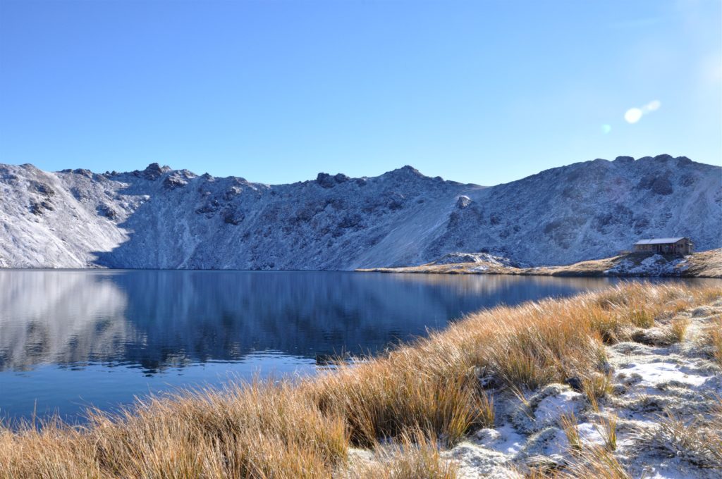
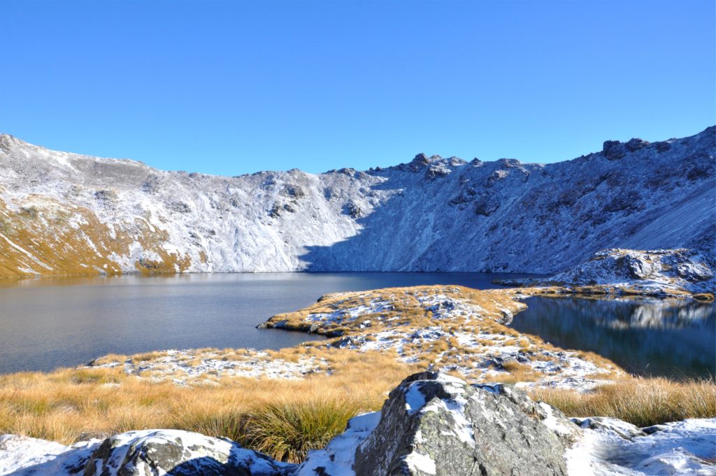
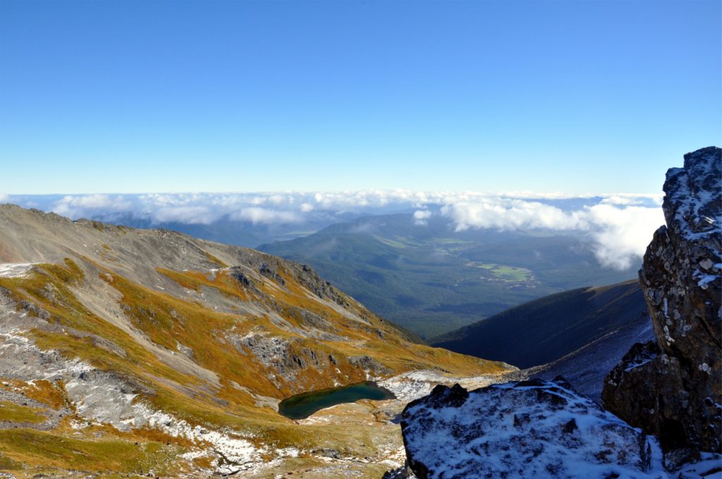
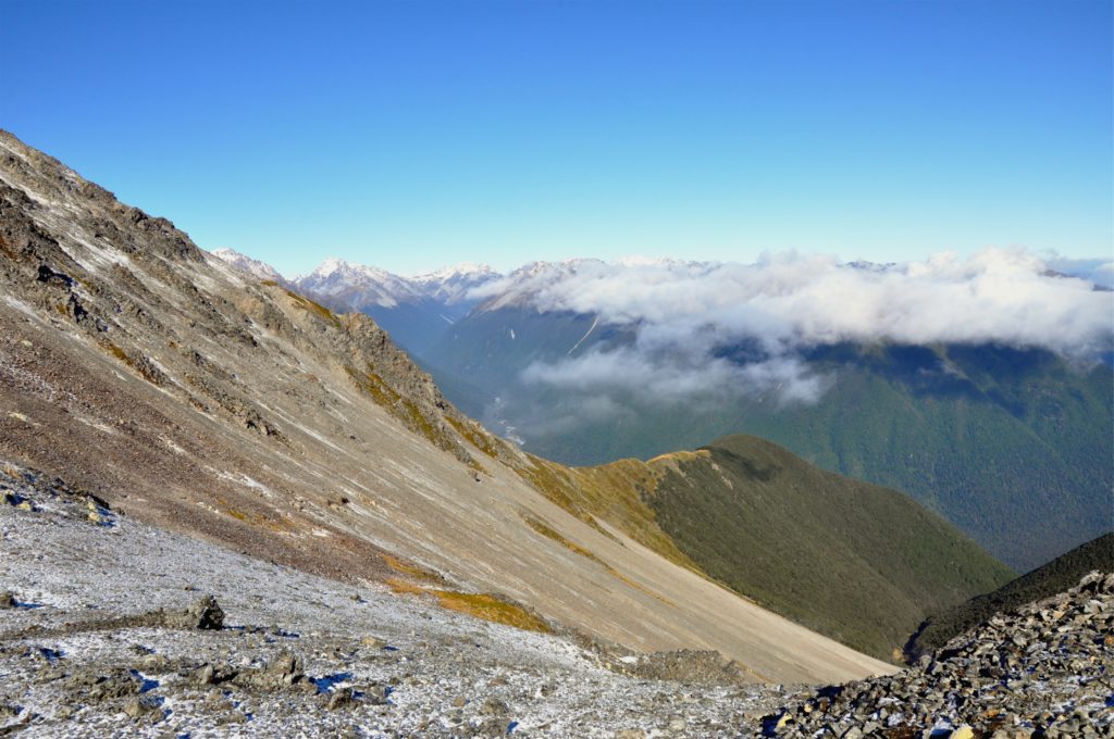
We climbed out of Angelus basin, picking our way carefully over the rocks that were still covered in snow. As we reached the first part of the ridge, we were rewarded with views down over Hinapouri Tarn and the Hukere and Travers River valleys.
Although we had stayed at Lake Angelus Hut before, we had never taken this route to or from the hut. We had selected this track in the hopes of seeing more of Nelson Lakes National Park, and on the map, the route along the ridge looked as if it would provide good views.
Having seen nothing the previous day, we had almost perfect conditions on our way down, and were pleased that we had chosen to take this route back down to the lake rather than continuing the circuit we had planned.
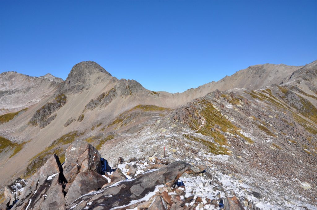
The clear skies gave us stunning views in every direction, but with the increased visibility, also came the realisation that we were walking on a very narrow ridge! Somehow the drop on either side looked a lot steeper when walking along with a heavy rucksack! You can just about make out the trail in the photo above, and see the next orange way-marker sticking out from a pile of rocks.
The rough track continued along the ridge, until we reached the summit of Mount Cedric. As we reached the peak the cloud started to build and the wind began to pick up again. We were glad that this was the highest point of our hike and that we would be starting to descend back towards the lake.
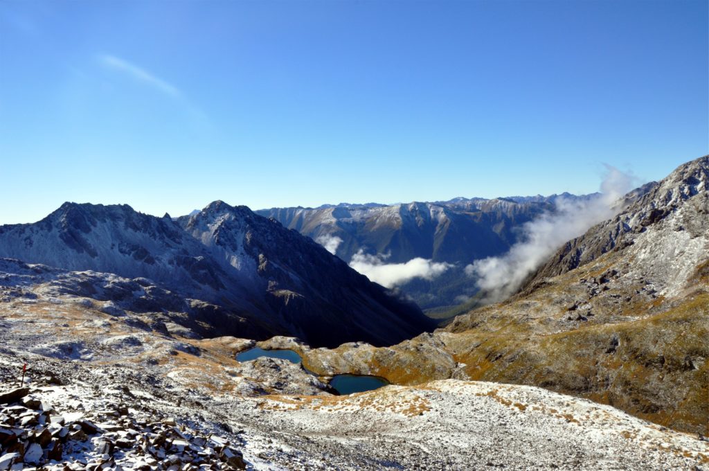
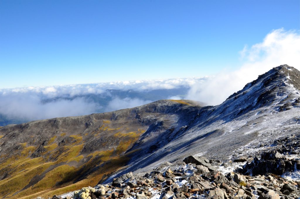
Once again, the excellent visibility meant that we had a very clear view of what lay ahead. From the track just before the summit of Mount Cedric, we could see the end of Lake Rotorora where we were planning on staying the night. As beautiful as it looked, we also realised that we had a pretty steep descent ahead of us.
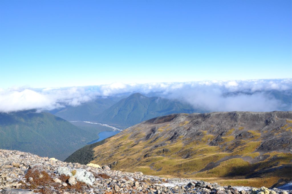
We crossed the final saddle, taking in views of the Sabine Valley before finding a spot for lunch. As we sat enjoying our meal we watched the clouds start to build again. By the time we started our descent through the Tussock grass to bush line, the clouds were already obscuring most of the views.
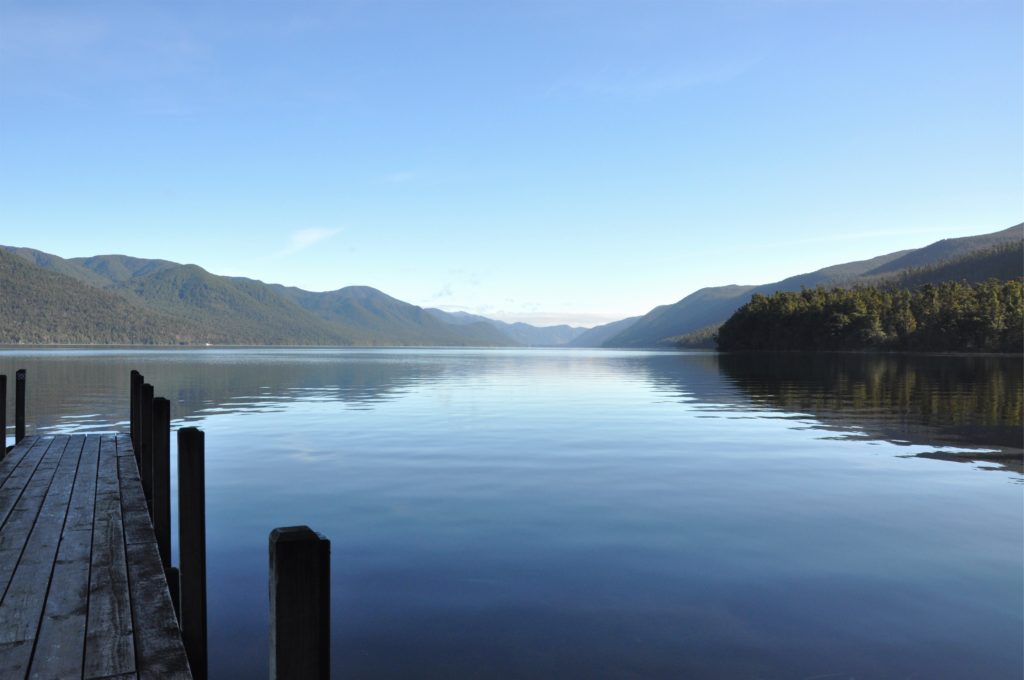
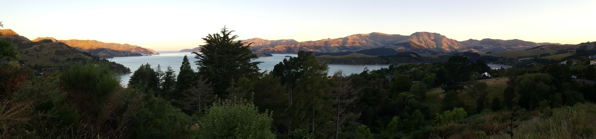
We spent a relaxing night at Sabine Hut, right on the shore of Lake Rotorora. The next morning we caught a water taxi back across the lake so that we could head back to Christchurch and get started on some more of the tasks that awaited us at the new house. Although we were disappointed to have to cut our trip a little short, we later heard that one of the passes we were hoping to cross was covered in snow which would have made for a difficult crossing, and when combined with more wet weather that moved through the area, meant that we felt we made the right decision. Now we just have to plan a return visit to see some of the places we missed on this trip!