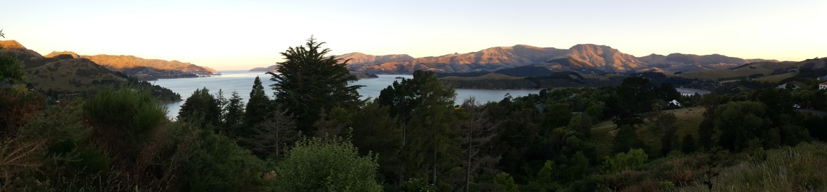
For our Christmas tramping trip this year, we picked the Rees-Dart track outside Queenstown. The track is an almost loop, which made the logistics a bit easier that some of the one-way tracks we have walked. As the name suggests the route would take us up the Rees Valley, over a pass and then back down the neighbouring Dart Valley. We built in an extra day to allow for a possible side trip to the Dart Glacier and crossed our fingers we would have good weather for that portion of the trip.
We started the hike in the Rees Valley, the entire valley is part of a big, privately-owned station, which is carefully managed. Although we were given some tips about following a four-wheeled drive track, it wasn’t clear where this mysterious track was and so we spent several hours carefully picking our way along the public footpath.
The side of the river valley was very marshy and Eric managed to slip into the mud up to his thighs at one point. The soggy terrain made for slow progress until we made it to the start of the public land where the track went into the bush and started to dry out. We continued climbing slowly through the forest until eventually we came out into a clearing and, after crossing a swing bridge, we found ourselves at the first hut.
The next morning we woke to the sound of rain on the roof of the hut, never what you want to hear when wrapped up in your sleeping bag. The forecast had indicated that the weather would clear, and with a short day of hiking ahead, we decided to have a slow start to the day.
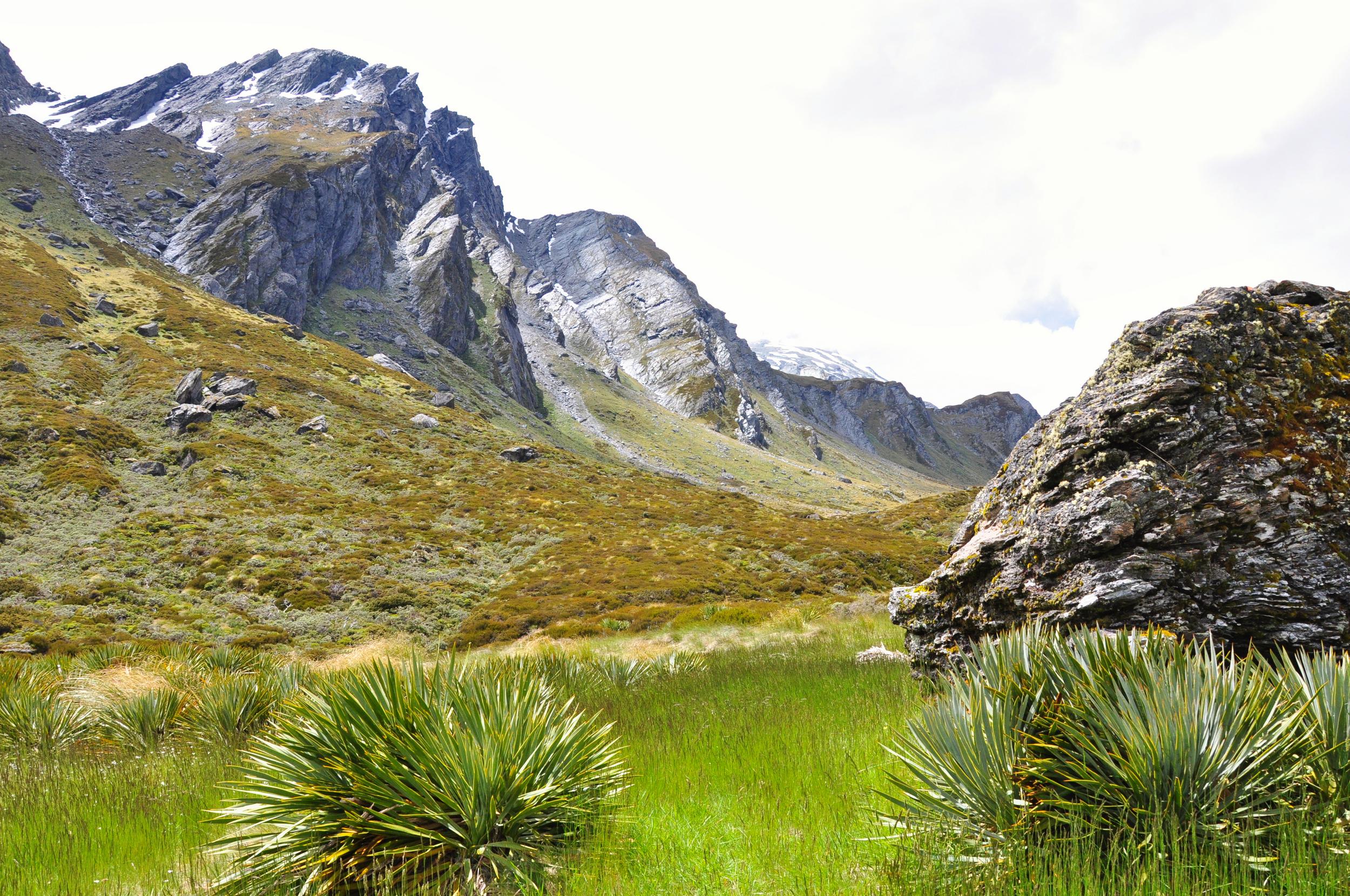
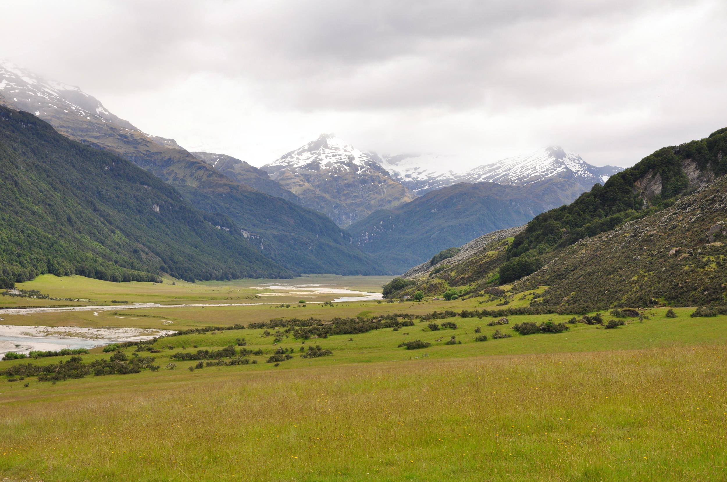
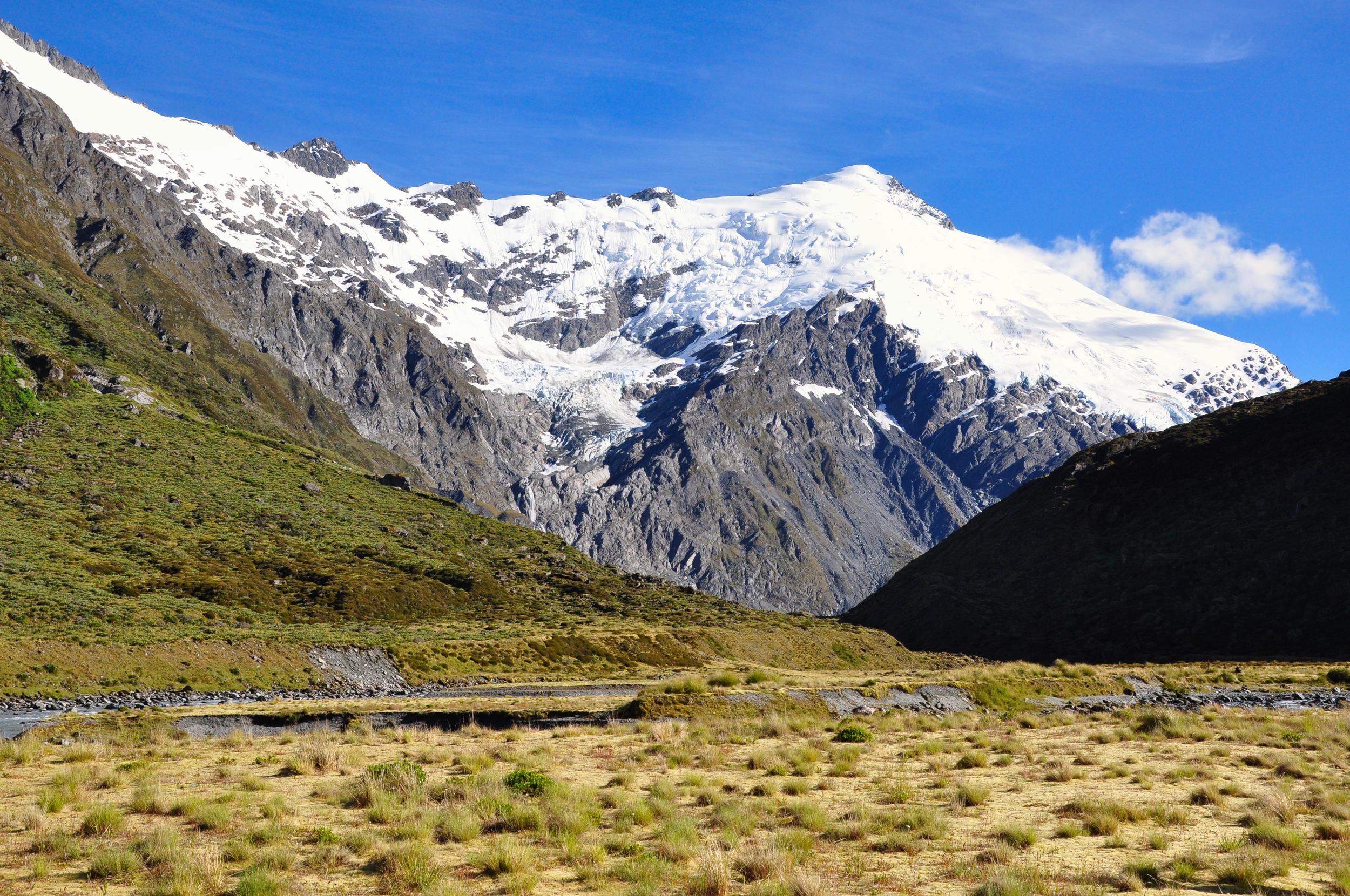
By mid-morning the rain was already finishing and the clouds starting to lift, so we finished packing up our gear and had an early lunch before continuing our walk. The track climbed steadily through the upper sections of the Rees Valley but the ever-changing scenery made for a pleasant hike as we made our way up to the saddle.
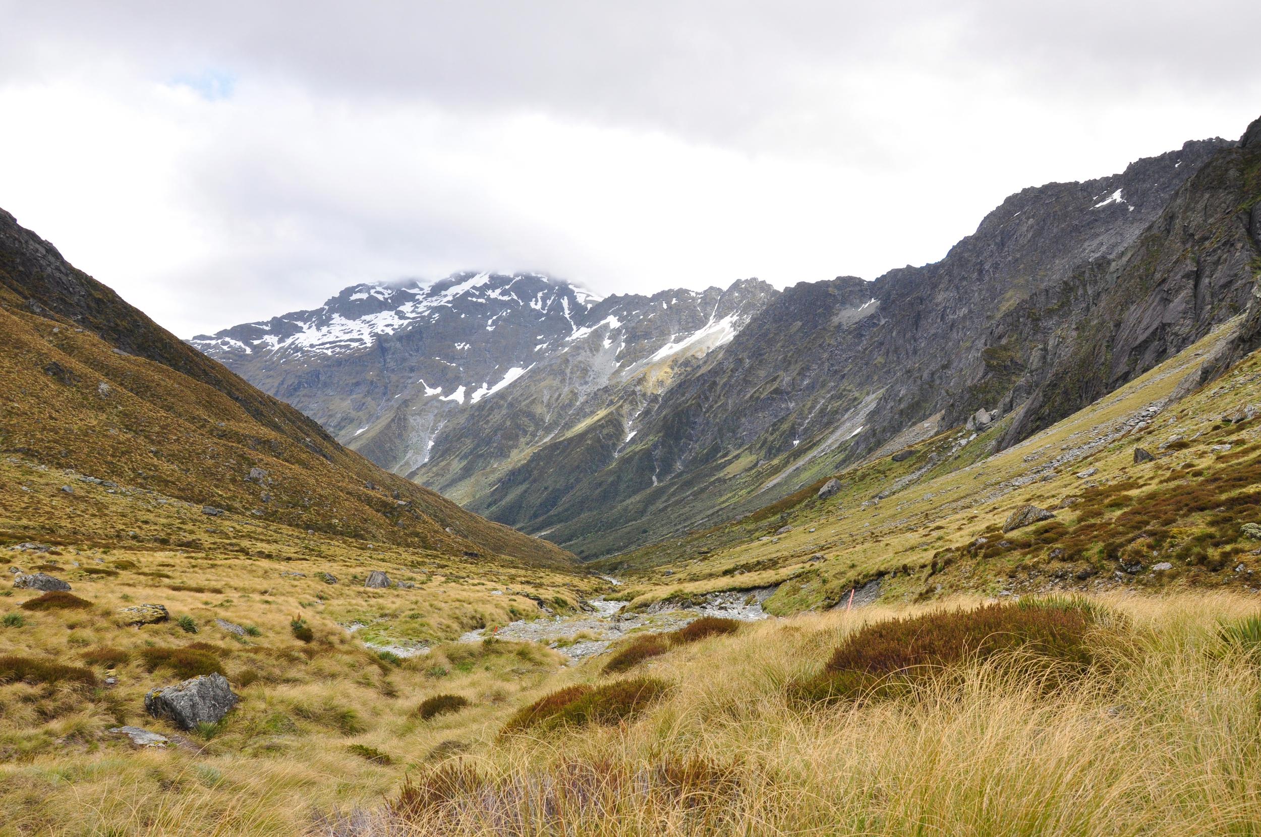
The final climb to the saddle was a bit of a scramble, but thankfully it was very short and we soon found ourselves looking down into the Dart Valley. The wind was blowing pretty hard as we started our descent, but it seemed to help chase away the last of the low cloud.

We followed a small creek down the valley, making for pretty easy walking, although there were a few sections where the track came pretty close to the edge, so we definitely needed to pay attention. In addition to the steep drop-offs we started to walk through more and more outcrops of Spaniard Grass or Giant Speargrass. As the name suggests these nasty bushes have incredibly sharp spines that can easily cut your legs or hands if you accidently brush against them.
Despite the relatively short day of hiking, it was still a welcome sight to see the hut come into view. We were pleasantly surprised to see that there were very few other people at the hut and we were able to get our pick of bunks for the night. We chatted with the ranger and were pleased to hear that the last of the weather should be clearing just in time for our planned side trip to the Dart Glacier and beyond.
The next day we woke to beautiful clear skies, the perfect conditions for heading up the Dart Valley towards the glacier and hopefully on up to Cascade Saddle. Cascade Saddle is a famously steep track between the Dart Valley and the West Matukituki Valley outside of Wanaka. We had hiked to Cascade Saddle before, but from the other side and so were keen to get a chance to head back up there.
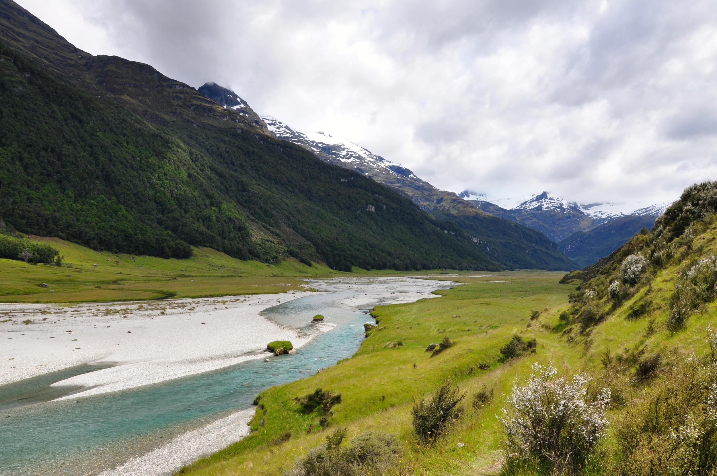
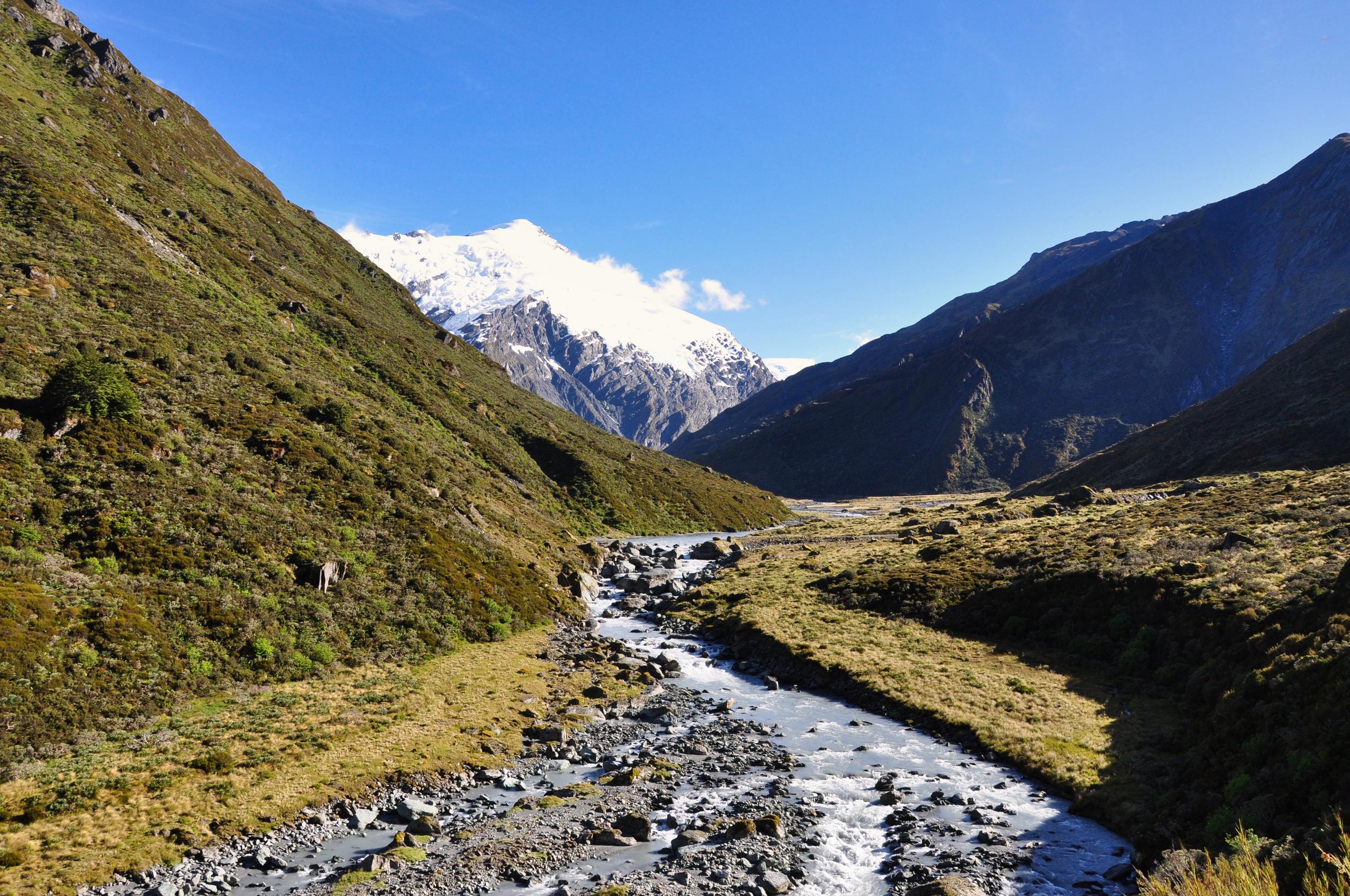
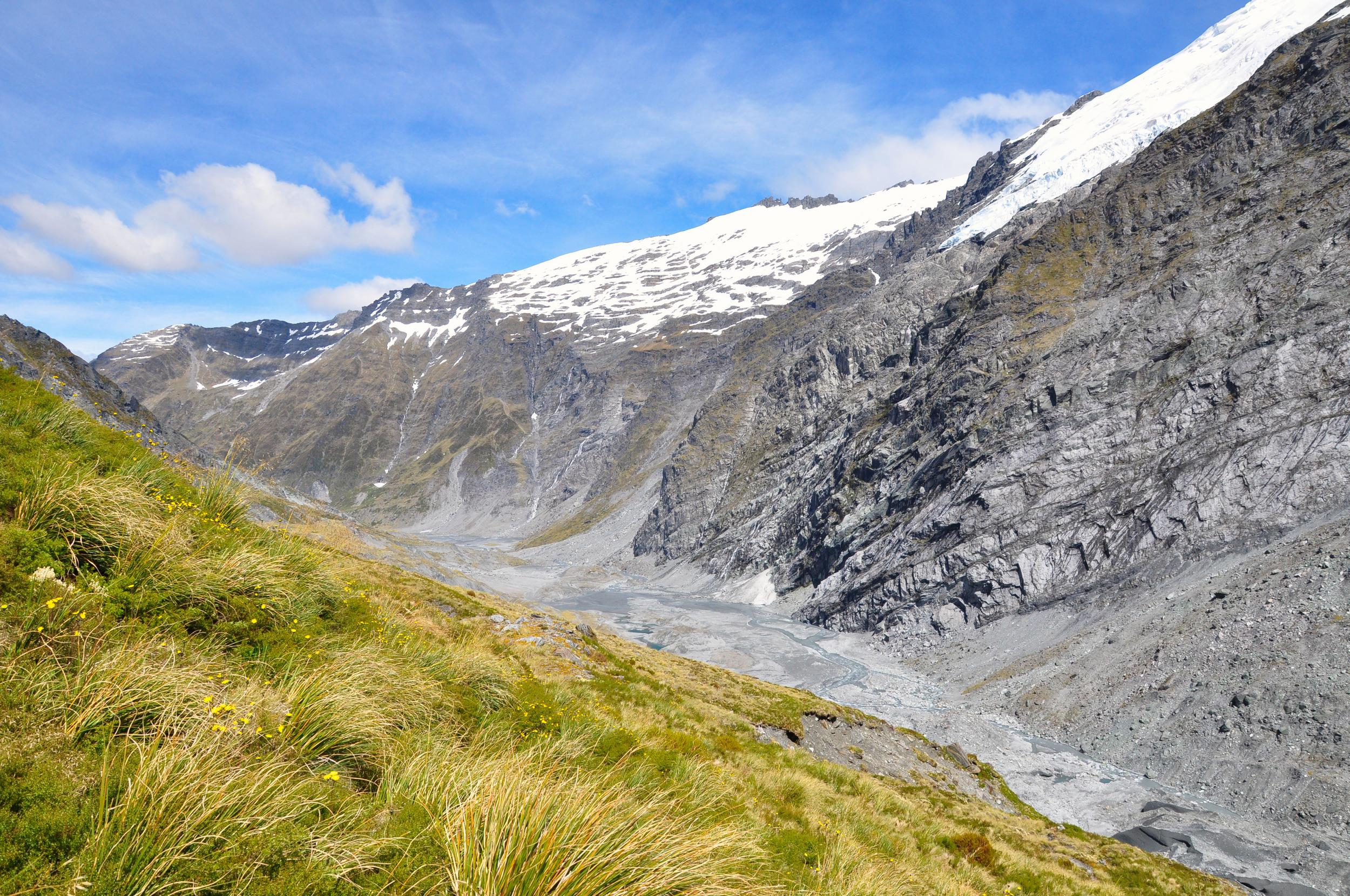
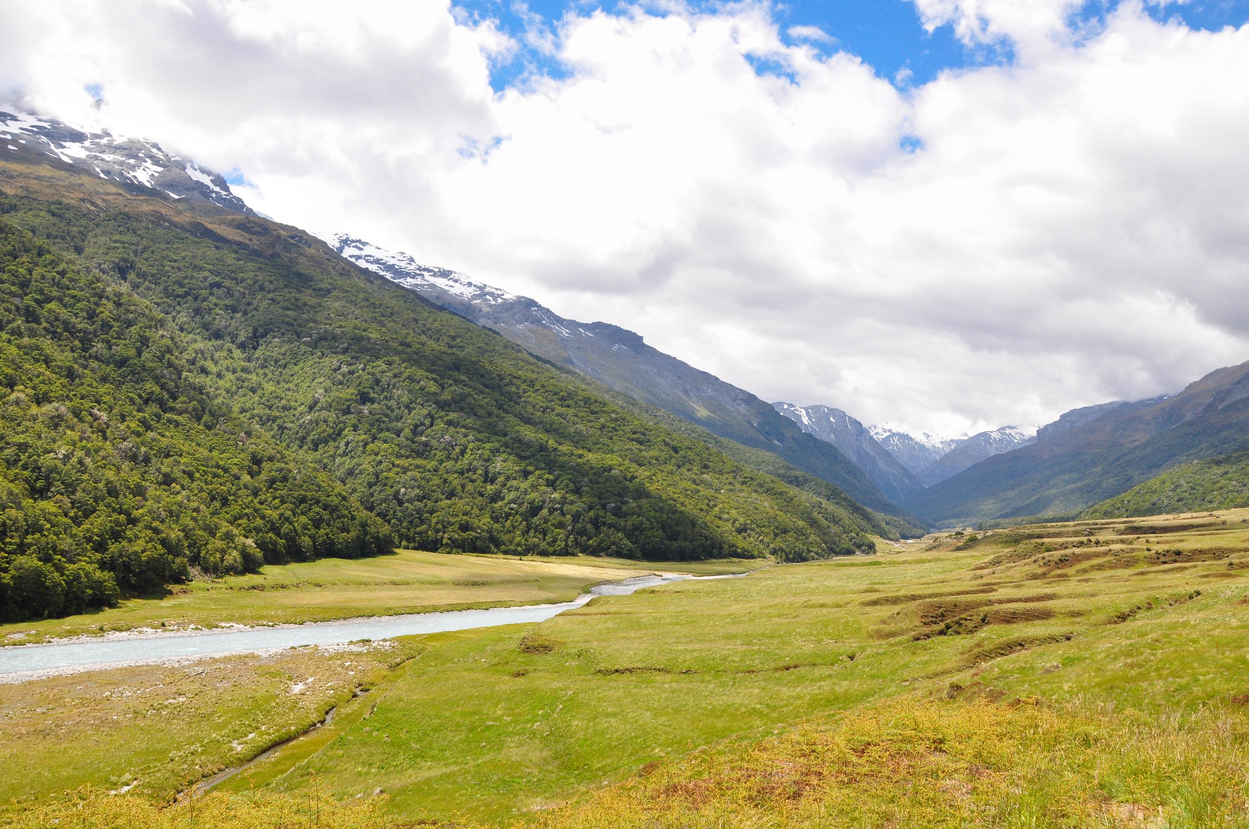
The track from the hut was a great way to start the day with a relatively easy walk along the river flats. However, there were a couple of river crossings that were pretty chilly first thing in the morning, which was hardly surprising given that we were only a few kilometers away from the glacier that was feeding the river.

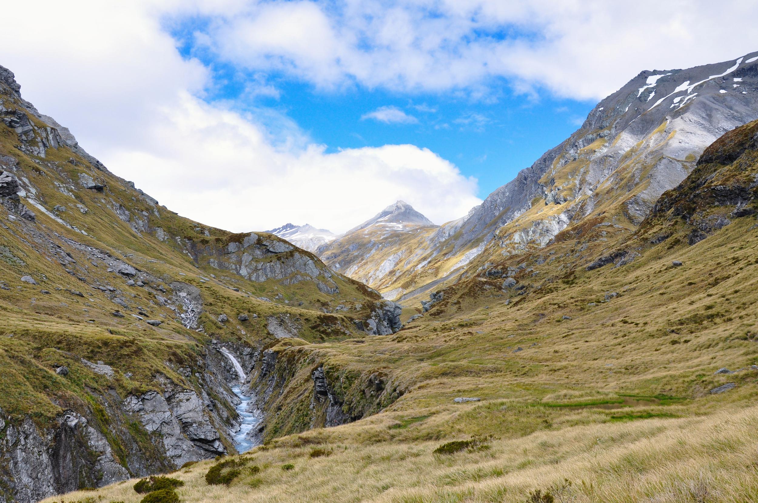
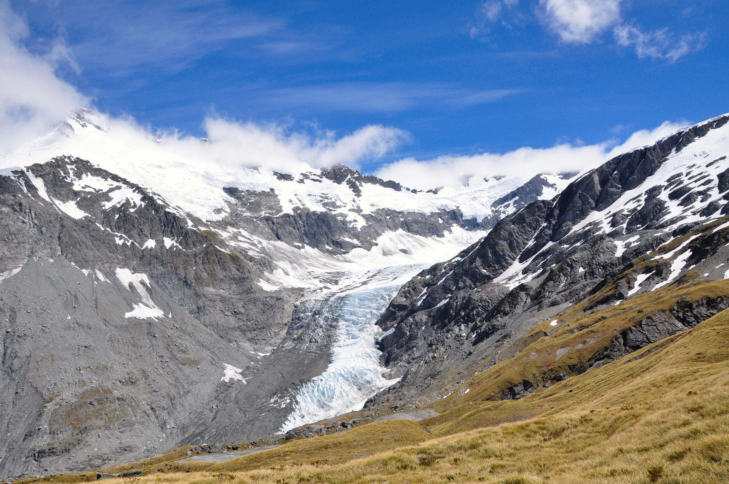
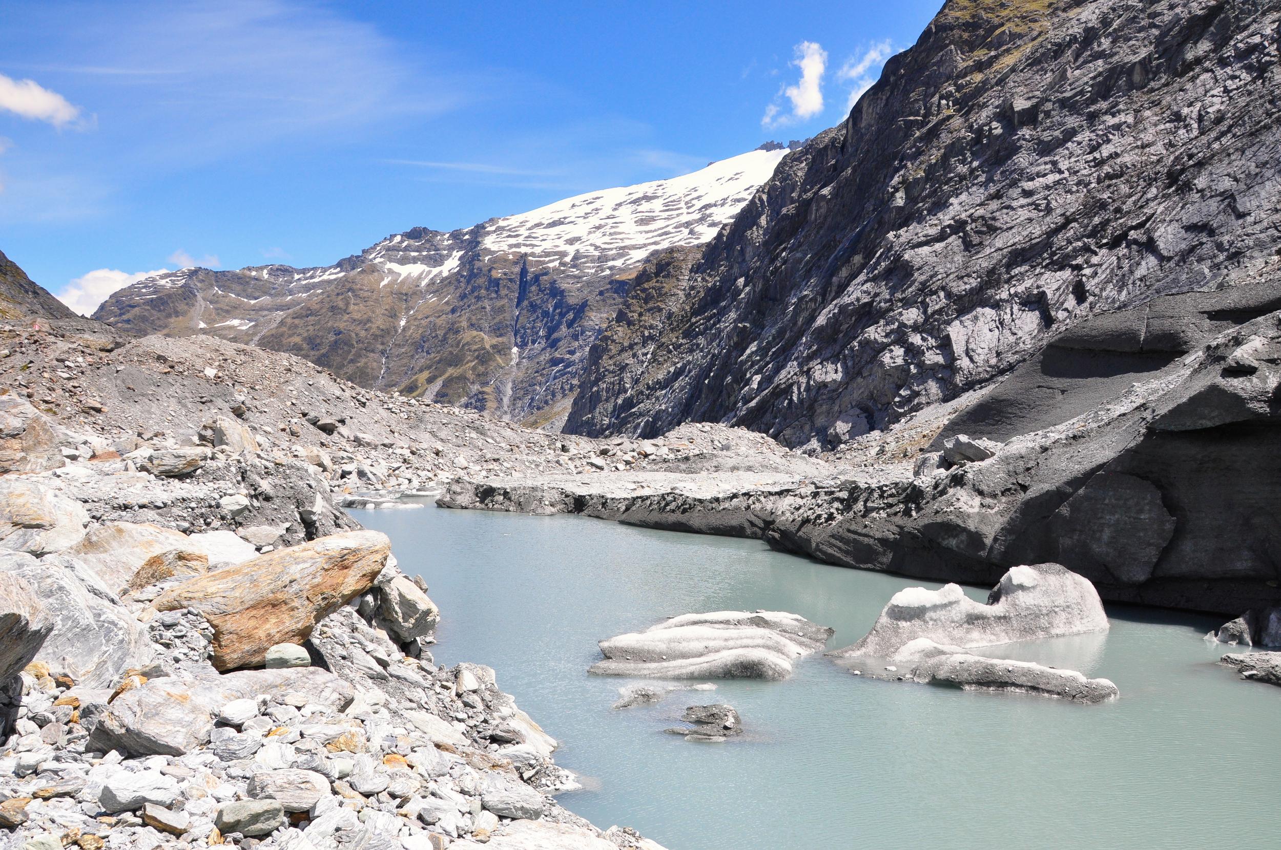
We reached the terminal face of the Dart Glacier and sat for a while watching the ice shift and change as it melted in the bright sunlight. With the weather still looking good, we decided to continue on up the slope towards Cascade Saddle.

After a short steep climb, more of the glacier started coming into view, including an amazing ice bridge near the end of the glacier. The lower slopes of the glacier were covered in so much debris, it was hard to make out the ice in places.
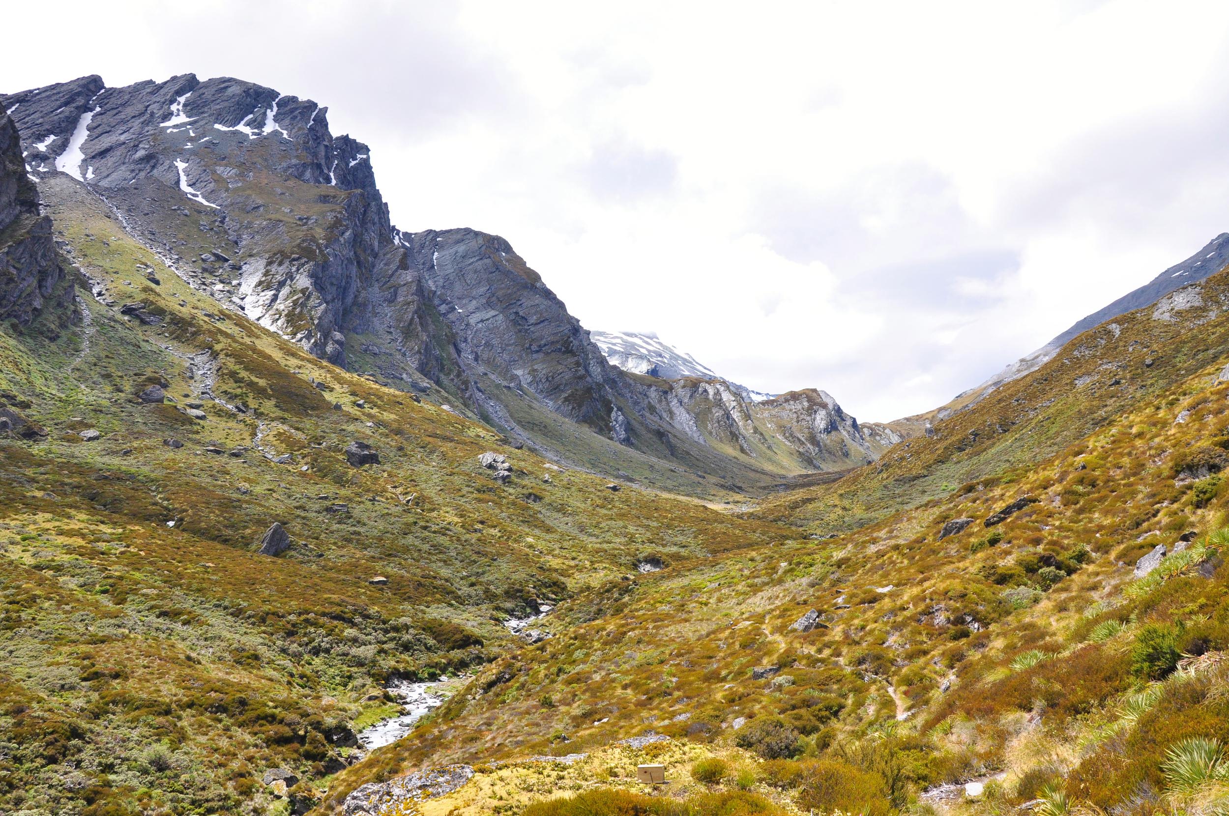
The track became much steeper as it crossed a large scree field making it pretty tricky to follow at times. Not only did it require some scrambling to keep moving through the slipperey rocks, but it wasn’t always easy to spot the next marker on the steep slopes. Luckily, the ever-changing views provided a great excuse to stop and catch my breath and scout around to pick out the next section of track.
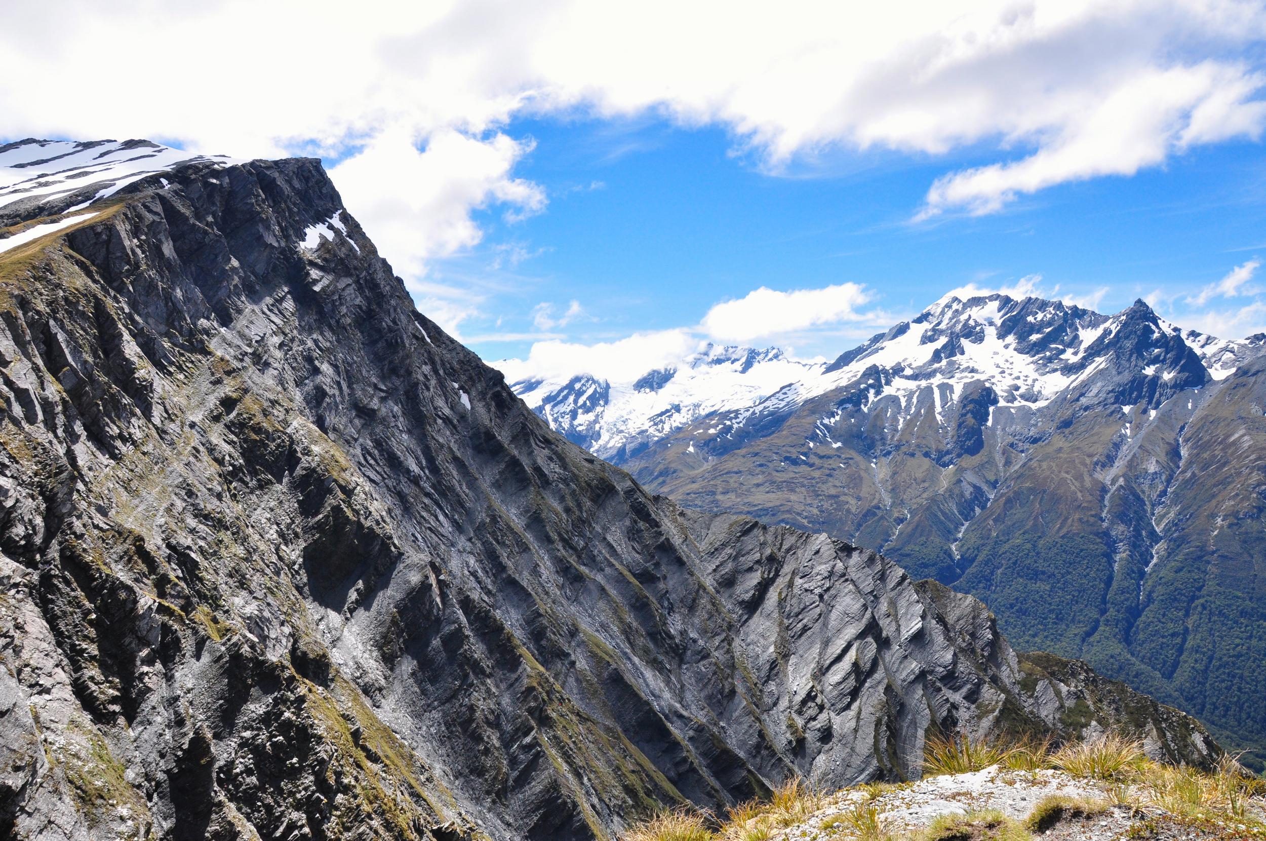
Finally the track exited the rocky section and was much easier to follow through the tussock grass near the saddle. It wasn’t long before the saddle came into view, knowing that the ground drops away pretty quickly, I slowly made my way over to the edge to enjoy the views.

From the Saddle you have great views up and down the Matukituki Valley, one of our favourite places to hike outside of Wanaka. From my perch high above the valley, I could pick out parts of the track that we taken in the past to French Ridge Hut and Liverpool Hut.
Sitting on the very edge of the saddle provided the perfect perch to enjoy a very scenic picnic. It was fun to look around and start to pick out places that were at least slightly familiar from our previous trips to this area. Eventually however, it was time to start the trek back down towards the hut as we still had a couple of days hiking ahead of us with our full packs.
After stopping for a while at the bottom of the slope to admire the mini icebergs that were being carved off the face of the glacier, it was time to get back to the hut for some dinner.
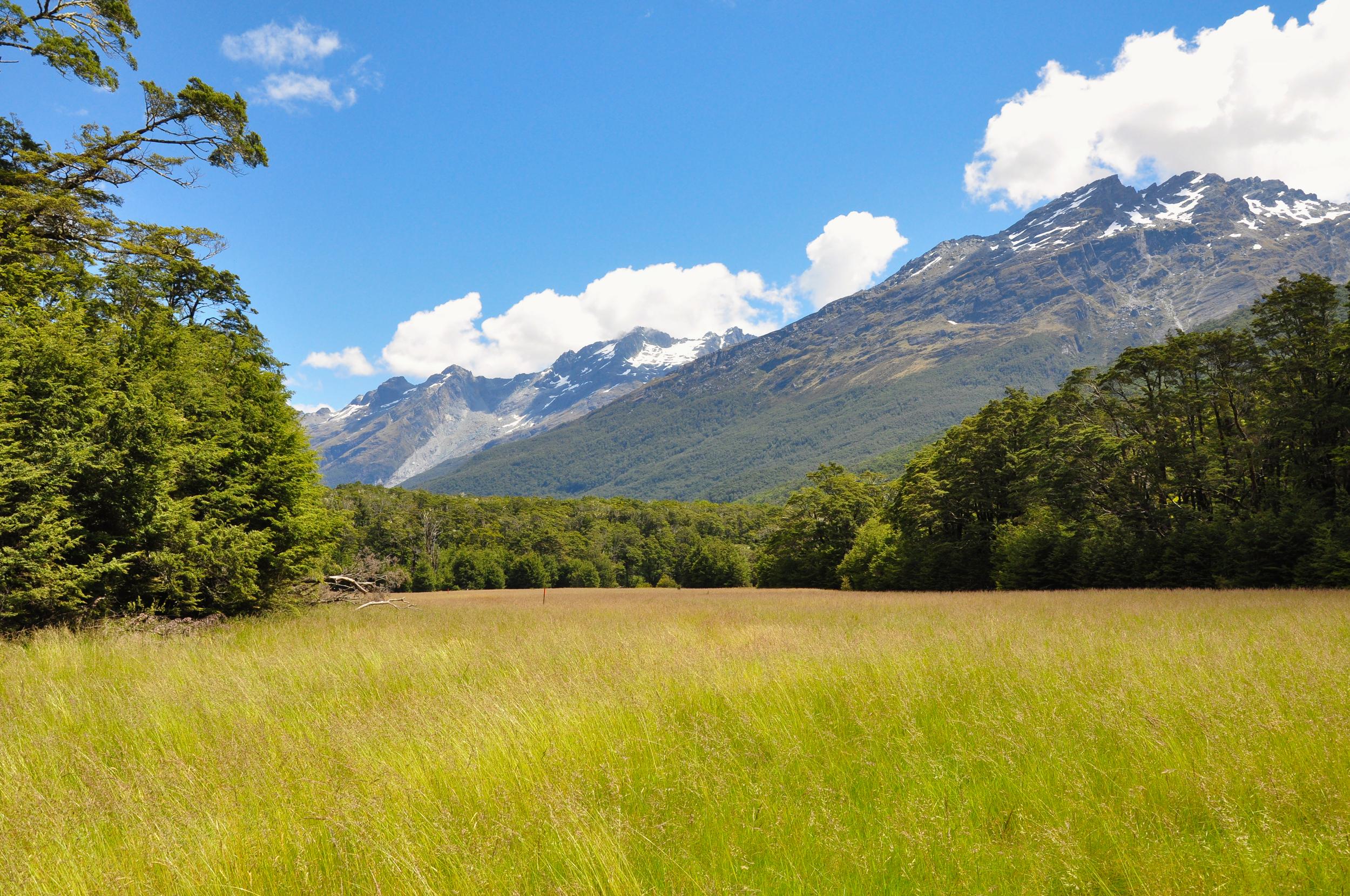
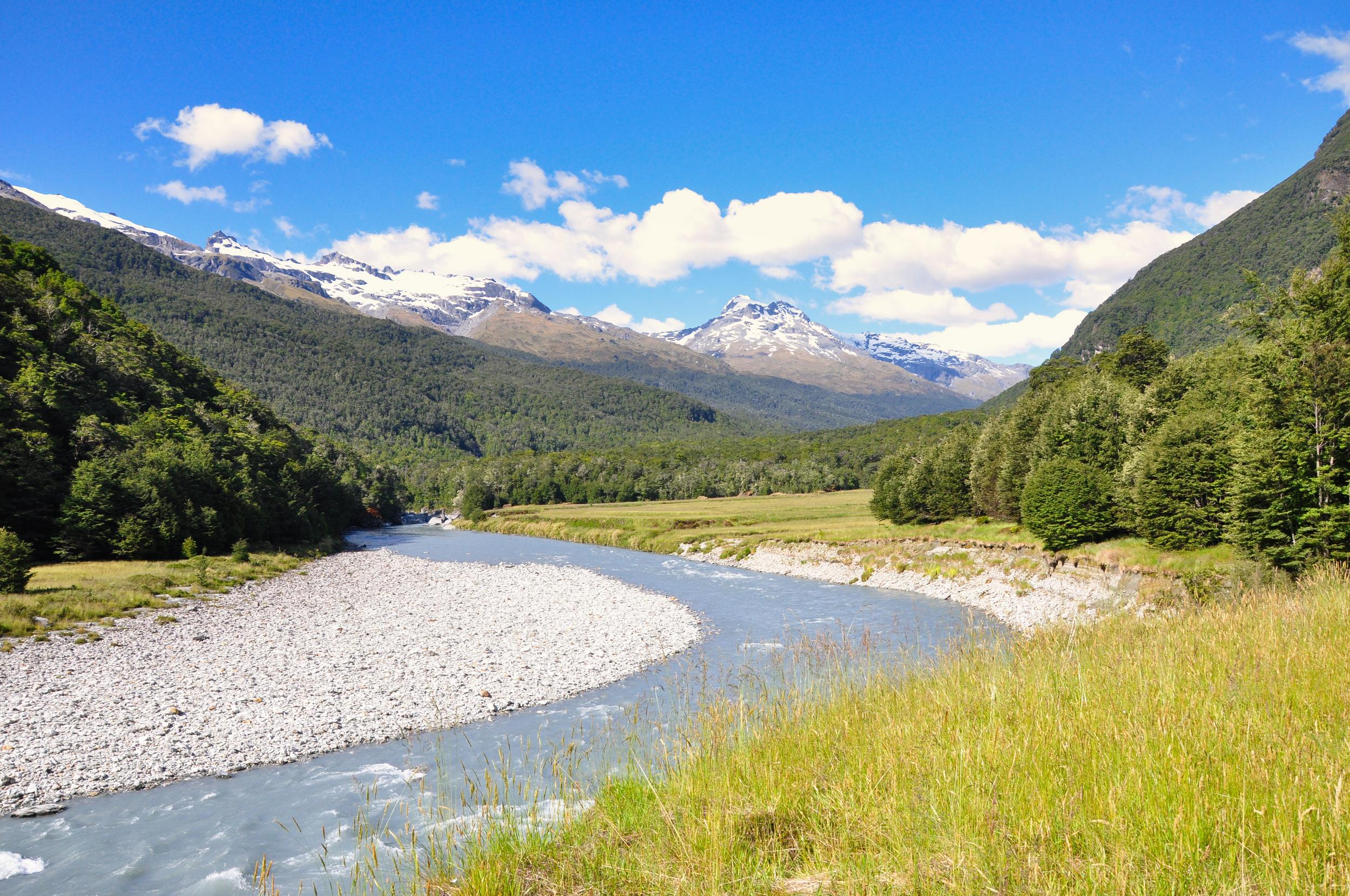
Our third day on the Rees Dart Track was another relatively simple one which followed the Dart River Valley out towards the lake near Glenorchy. The uppers sections of the valley near the hut were through dense bush but later in the day the valley started to open up and we got to walk through the grassy river flats.
The clouds continued to lift and we had great views of the surrounding mountains. Despite it being close to Christmas we were amazed to have almost the entire valley to ourselves, only seeing a couple of other people all day.
We arrived at the hut by mid-afternoon and briefly contemplated a swim, however the combination of sandflies and chilly (glacial ?) water meant that we decided to enjoy the view from inside the hut instead.
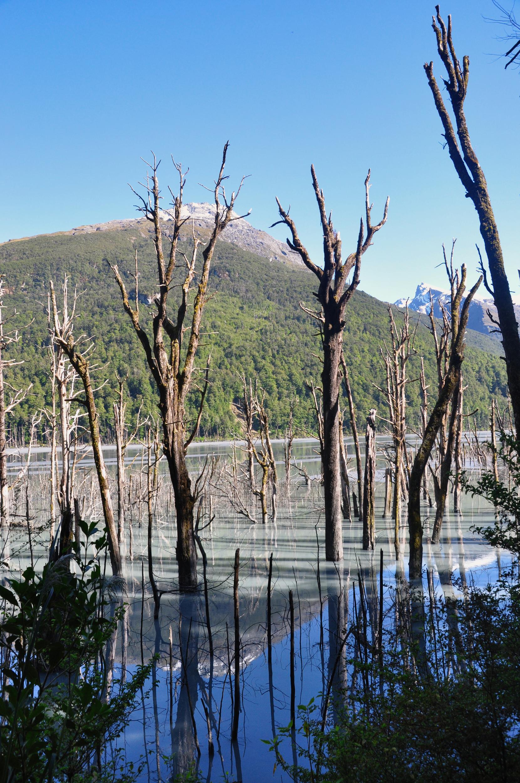
Our final day of walking took us further along the Dart River Valley, through a strange section of the river that had been impacted by flooding in 2014. A large landslide blocked this section of the river valley, causing a lake that was over 3 kilometers long and 20 metres deep to form, killing the trees that were close to the river bed. Eventually the lake drained naturally, limiting any further damage to the area.
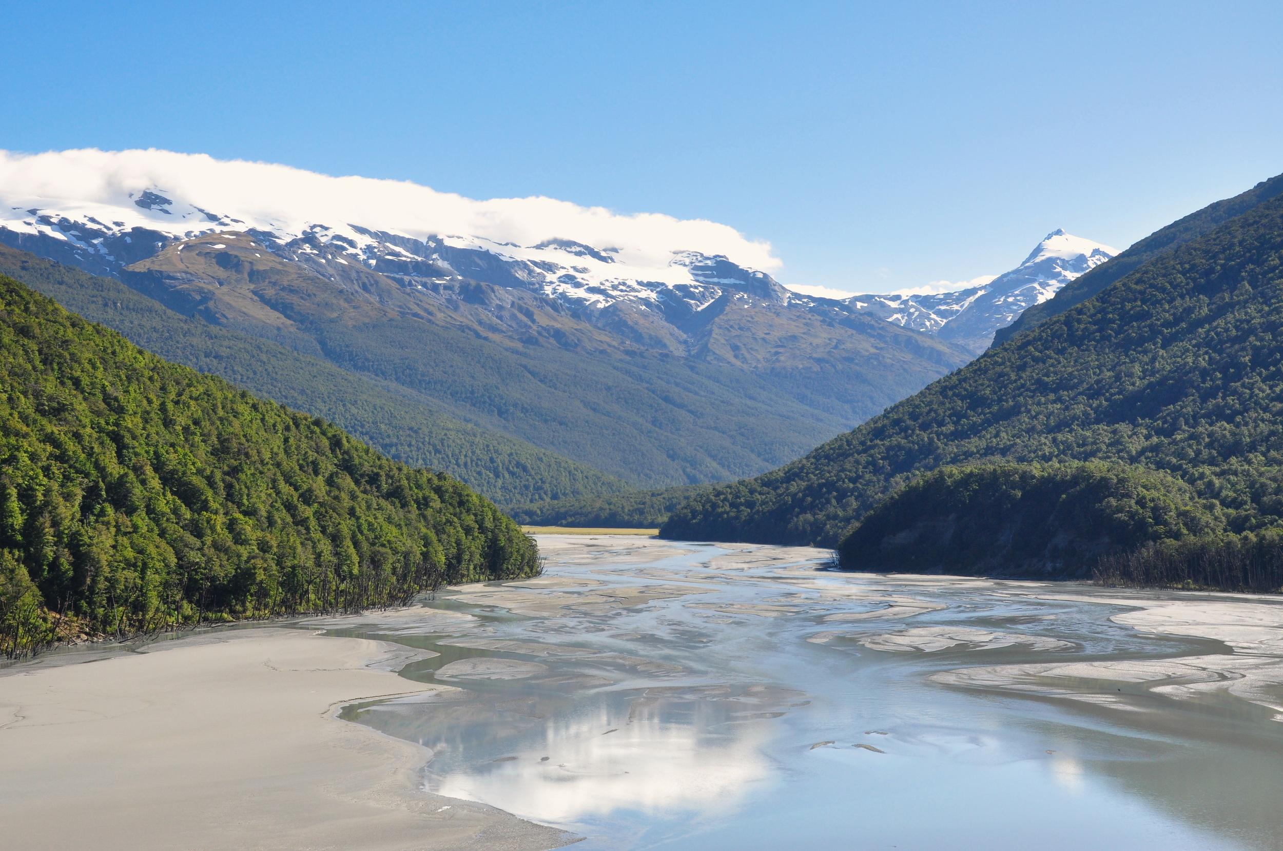
Given the instability in the area, the Department of Conservation moved the walking track to higher ground, and whilst this meant a bit more climbing for us, it did give us some great views down over the braided river.

The valley continued to open up and soon we could pick out the landmarks around the head of Lake Wakatipu that marked the end of the track. We arrived back in the car park, pleased to find that our car had been relocated for us and that the snacks that we had stashed were waiting for us. Despite only being less than twenty five kilometers from where we started, by road, we definitely felt as though we had taken the scenic route around getting to see two really beautiful mountain valleys.